Discern Your Local Native Soil Type (within Australia)
This Australian Government site is an excellent resource for more than just soils and you may wish to explore its data further — but please note that it is a heavy user of RAM and performance may be affected, especially over a slow network.
From their About page:
“NationalMap is an online map-based tool to allow easy access to spatial data from Australian government agencies. It was an initiative of the Department of Communications and the Arts (DCA) now currently managed by the Digital Transformation Agency (DTA) and the software has been developed by Data61 working closely with the DCA, Geoscience Australia and other government agencies.”
How To Identify Your Native (Australian) Soil Type
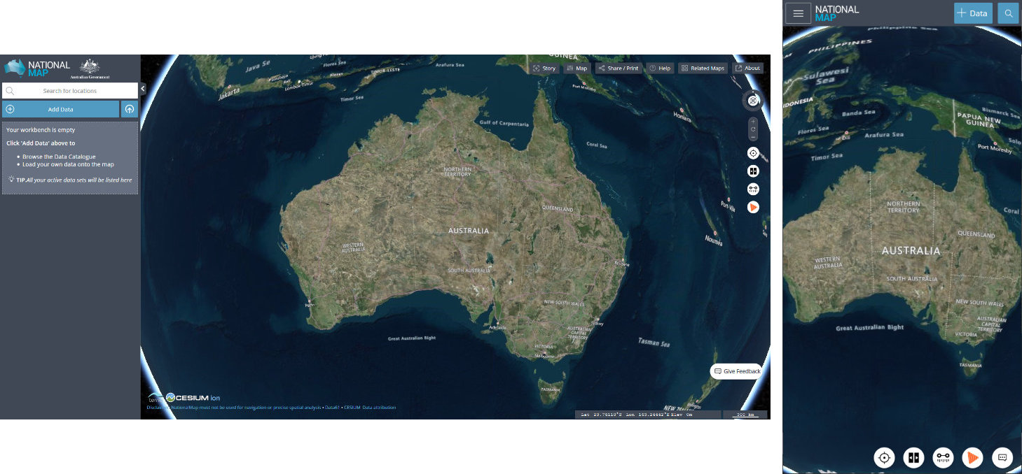
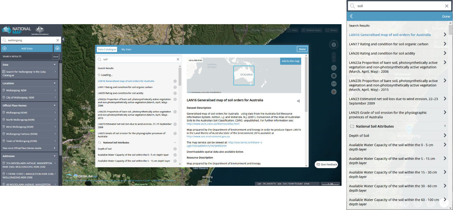
The following Figures are from a search on the Wollongong region. For each, the screenshot on the left represents the search on a computer monitor, while the screenshot on the right represents a mobile screen. The exception is Fig. 4a which shows a mobile screen only.
With NationalMap open (Fig. 1),

enter your town, local area, or even exact address into the ‘Search for locations’ field at top left (computer), or tap on the magnifying glass icon at top right (mobile) to enter (Fig. 2). Several results may appear for ‘Locations’, ‘Official Place Names’, and ‘Addresses’ — click/tap on the most appropriate and the map will automatically zoom in to there.

Click the blue ‘Add Data’ (computer) or tap the ‘+ Data’ (mobile) button (Fig. 2) to open up the available catalogues to search.
On a computer, the ’search the catalogue’ field is immediately visible (Fig. 3).
On a mobile, tap the magnifying glass icon to reveal this search field.
Enter ’soil’ into this field to reveal the LAN16 Generalised map of soil orders for Australia at top. Select and click/tap ‘Add to map’.

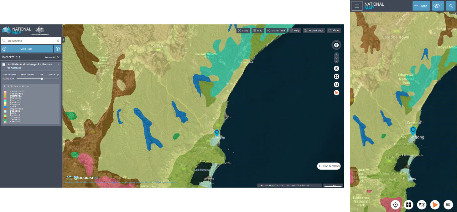
A semi-transparent overlay will appear (Fig. 4).

This is a colour-coded soil map overlaying the geographical map, and its semi-transparent nature allows you to view the geographical features including towns and roads underneath. Use this visibility to zoom right in to your exact address, if you haven’t already done so, before proceeding further.
The colour-coded legend of the Australian soil orders will display on the left-hand side of a computer monitor (Fig. 4). On a mobile you will first need to tap the eye icon which has appeared at top right to reveal the legend and slider (Fig. 4a). Tap the eye icon again to hide this and return to the soil map (Fig. 4).

Slide the opacity slider immediately above the legend fully to the right, so that opacity equals 100%. The obscures the geographical map but fully saturates the soil map colours for easier comparison with the legend.

Take care when reading the map, as the colours and names don’t quite line up in the legend. A misreading may also result if your screen does not render colours accurately — the greens representing Dermosols and Rudosols especially could be problematic.
This map shows that Wollongong city is situated on Podosols, soils high in sodium. Immediately surrounding these are the Dermosols, and Kandosols predominate further west.
A 2.4MB PDF of the 14 Australian soil orders showing their locations and with representative photographs is available here.
About the Author
BSc(Hons), U.Syd. - double major in biochemistry and microbiology, with honours in microbiology
PhD, U.Syd - soil microbiology
Stumbled into IT and publishing of all things.
Discovered jujube trees and realised that perhaps I should have been an agronomist...
So I combined all the above passions and interests into this website and its blog and manuals, on which I write about botany, soil chemistry, soil microbiology and biochemistry - and yes, jujubes too!
Please help me buy a plant if you found this article interesting or useful!